Agricultural sustainability is closely connected to how efficiently farms use finite resources. Seed, fertilizer, crop protection products, fuel, water, labor, and machinery time all contribute to field operations. Applying the same treatment everywhere may be convenient, but fields rarely behave as perfectly uniform spaces. Precision farming addresses this variation by using location-specific information to make agricultural operations more targeted.
The sustainability value comes from the mechanism rather than from technology alone. When farmers can identify where an operation is required, guide machinery accurately, and control applications accordingly, resources can be directed toward productive areas instead of being distributed without sufficient spatial distinction.
Why Resource Efficiency Starts With Knowing What the Field Needs?
A field can contain differences in soil characteristics, crop condition, moisture, terrain, and previous management. Treating every part identically can therefore result in resources being used where they are less necessary while other areas receive insufficient attention.
Precision agriculture solutions provide the technological foundation for identifying and responding to this variation. Positioning systems, sensors, field mapping, and agricultural machinery can work together to associate observations with specific locations.
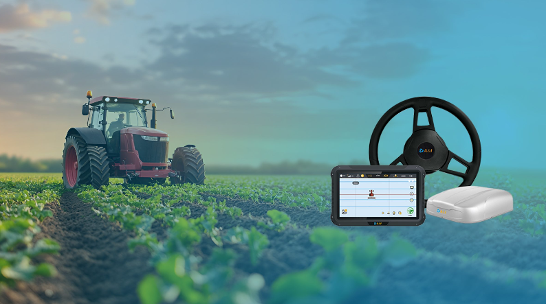
Archimedes Innovation’s smart agriculture solution portfolio combines technologies such as high-precision GNSS, agricultural machinery positioning, and autonomous driving for agricultural applications. The company presents these technologies as components for precision agricultural operations.
Accurate location is particularly important because field information becomes more useful when it can be connected to a precise position. A measurement without a reliable spatial reference is difficult to translate into a repeatable machine action.
How Location Data Changes the Way Inputs Are Applied?
Once agricultural information is associated with specific field locations, management decisions can become more targeted. Instead of considering the entire field as a single operating area, farmers can use spatial information to distinguish areas that require different treatment.
The same principle applies across multiple operations. A positioning system can guide machinery along planned paths, while field data can inform where particular operations should take place. This creates a link between what the farmer knows about a field and where machinery actually performs the work.
Precision farming for sustainable agriculture therefore depends on the combination of information and action. Mapping a variation does not by itself reduce resource consumption. The operational system must be capable of using that information when machinery is working in the field.
High-precision GNSS provides one of the underlying location references. Archimedes Innovation identifies agricultural GNSS positioning and tractor auto-steering among its smart agriculture technologies, supporting the connection between accurate positioning and controlled field operations.
Where Automation Reduces Unnecessary Passes and Overlap?
Resource efficiency is not limited to the amount of material applied. Every machinery pass consumes time, fuel, labor, and equipment capacity. Unnecessary overlap can increase these costs without creating corresponding productive value.
Guidance and automated steering can help machinery maintain planned routes across successive field passes. Consistent positioning allows the tractor or implement to follow established paths rather than relying entirely on visual alignment.
The AS10 agricultural GNSS receiver, for example, is designed for applications including tractor auto-steering and precision agriculture. Its product information specifies dual-antenna GNSS positioning and RTK capabilities for agricultural machinery.
Better route consistency can be particularly relevant for operations involving repeated passes. If the working width of an implement is known, maintaining an appropriate distance between passes can help limit unnecessary overlap and avoid leaving untreated gaps.
The sustainability mechanism is therefore straightforward: more controlled machine movement can reduce avoidable work. Less unnecessary travel can mean more efficient use of fuel, machinery hours, and labor while maintaining the intended field operation.
Why Precision Farming Depends on More Than Accurate Positioning?
Positioning is essential, but it is only one component of a precision farming workflow. Sustainable resource optimization requires information to move from observation to decision and finally to physical action.
A typical architecture may connect GNSS positioning with agricultural machinery, sensors, computing equipment, and control systems. Each component has a different role. Positioning establishes where the machine is; sensors can provide information about conditions; computing can process available data; and control systems translate decisions into machine behavior.
Archimedes Innovation’s smart agriculture approach brings together positioning and autonomous driving technologies as part of an integrated agricultural solution. This reflects the practical requirement for multiple technologies to work together rather than treating GNSS as an isolated sustainability tool.
System integration also determines how effectively field information can be used. A highly accurate position becomes less valuable if the machine cannot interpret the information or respond to it through an appropriate control interface.
How Better Resource Decisions Translate Into More Sustainable Farming?
Precision farming improves sustainability by making resource use more deliberate. Field-level information can identify variation, positioning can associate that information with specific locations, and automated machinery can execute operations according to planned paths.
The result is a shift away from treating every square meter identically. Instead, agricultural operations can increasingly reflect actual field conditions and operational requirements. This can support more controlled use of inputs and reduce avoidable machinery movement.
Precision agriculture solutions should therefore be evaluated as complete workflows rather than isolated products. The relevant question is not simply whether a receiver is accurate or whether a tractor can steer automatically. It is whether the combined system can convert field information into repeatable, location-specific action.
In order to demonstrate this system-level approach, Archimedes Innovation has developed smart agriculture technologies that integrate autonomous driving, agricultural machinery, and high-precision positioning.
Sustainability ultimately comes from better resource decisions. Precision farming provides the technical means to understand where resources are needed, guide machinery more consistently, and reduce unnecessary operations. By connecting accurate spatial information with practical field control, farms can pursue greater resource efficiency without treating technology itself as the end goal.
